01
Field Collection
Collect existing conditions, property evidence, utilities, structures, and site features using survey equipment.
Loading portfolio
Residential Land Development
Supporting residential projects through field surveying, lot layout, improvement documentation, utility coordination, and grading-related drafting.
Role
Survey/Civil Engineering Intern
Project Type
Residential Development
Primary Software
Carlson Survey and Civil 3D
Work Environment
Field and office
Field Collection
GPS, total station, data collector, and prism
Drafting
Property lines, improvements, easements, and utilities
Documentation
Proposed improvement plans and final survey plats
Design Context
Residential lots, subdivisions, roads, and grading
Overview
Residential lot development required more than documenting a building footprint. Each drawing combined property geometry, setbacks, easements, road frontage, driveways, utilities, structures, grading information, and neighboring conditions.
My work supported projects from initial field collection through office drafting and final survey documentation. Moving between those stages helped me understand how individual measurements become part of a complete development record.
Project Workflow
01
Collect existing conditions, property evidence, utilities, structures, and site features using survey equipment.
02
Import and organize GPS and total-station observations before developing usable survey linework.
03
Document boundaries, setbacks, easements, building footprints, decks, driveways, and neighboring parcels.
04
Verify constructed improvements and prepare clear survey documentation showing their locations.
05
Develop or review contours, finished elevations, drainage patterns, slopes, and surface information.
Existing Conditions
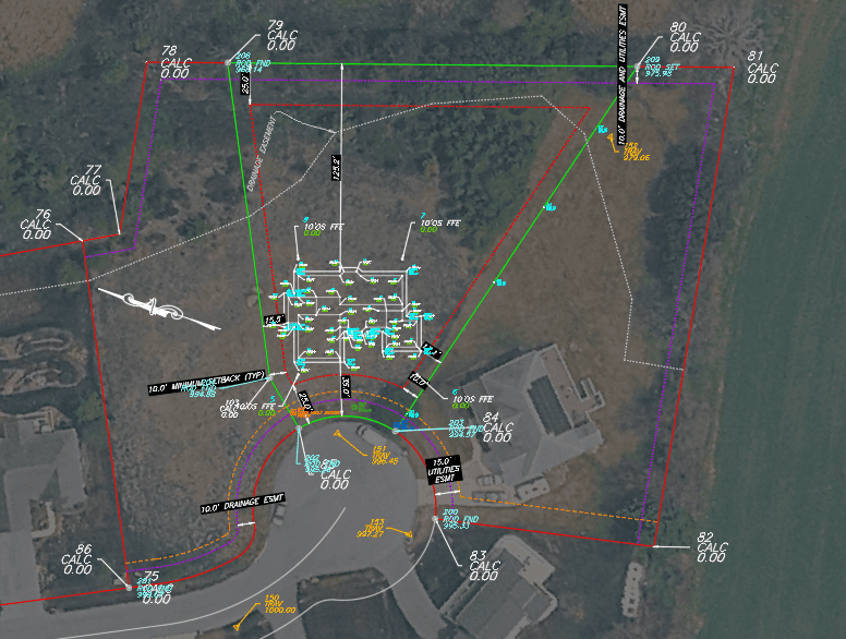
Aerial imagery helped provide visual context for property lines, easements, utilities, road connections, structures, and collected field information. The overlay connected technical survey data with recognizable site conditions.
Lot Planning
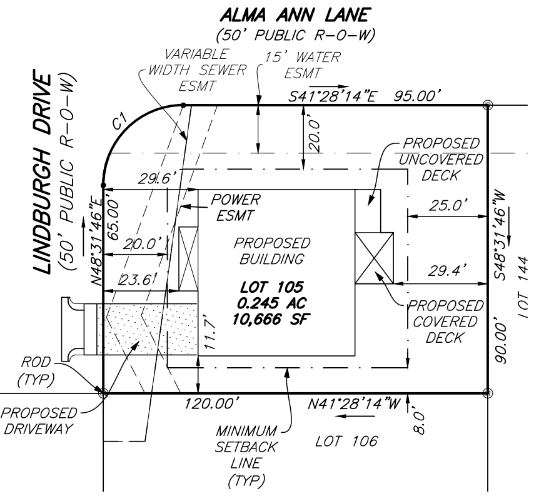
This plan brings together the proposed building, covered and uncovered decks, driveway, minimum setbacks, easements, lot dimensions, road frontage, and adjacent property information.
The drawing demonstrates how residential improvements must be positioned within a defined legal and infrastructure framework rather than treated as isolated structures.
Improvement Survey
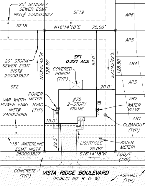
The SF1 improvement survey documents the completed residence, porch, driveway, utilities, easements, dimensions, and relationship between the improvements and property boundaries.
This type of deliverable depends on accurate field verification and clear drafting so the constructed condition can be reviewed against the lot requirements.
Grading Context
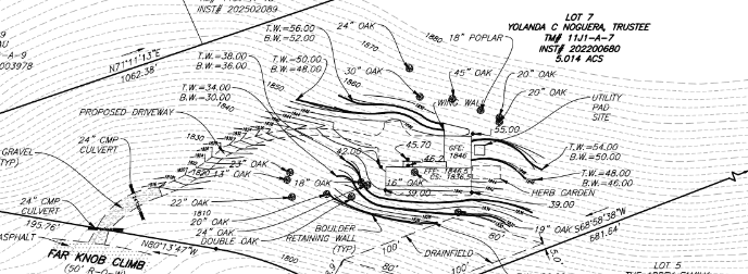
The grading plan shows how individual residential lots connect to roads, slopes, drainage features, contours, and the larger subdivision. It reinforced that lot development decisions must support the performance of the entire site.
Engineering Challenges
Residential lot work required each property, structure, utility, and dimension to be considered as part of one coordinated system.
01
Each lot required the proposed building and supporting improvements to fit within a unique combination of boundaries, setbacks, easements, and road frontage.
02
Water, sanitary sewer, storm drainage, power, and other infrastructure had to be shown clearly relative to proposed structures and property limits.
03
Field observations had to remain consistent throughout processing, drafting, verification, and final documentation.
04
The final plans needed to communicate dense technical information without losing the hierarchy of the most important dimensions and site features.
What I Learned
This work strengthened my understanding of how property boundaries, structures, utilities, grading, road frontage, and construction documentation depend on one another.
It also reinforced the importance of maintaining survey accuracy from the original field observation through the final drawing. Every point and dimension contributes to decisions made later in the project.