01
Review Design Information
Review available plans, utility layouts, structures, and project requirements before beginning field collection.
Loading portfolio
Field Verification & Documentation
Documenting constructed utilities, site improvements, structures, and elevations through field surveying and final drafting.
Role
Survey/Civil Engineering Intern
Work Type
Field and office
Project Context
Residential and commercial
Main Focus
Constructed-condition records
Project Types
Residential development and commercial construction
Field Equipment
Trimble GPS, total station, data collector, and prism
Office Software
AutoCAD and Carlson Survey 2024
Deliverables
As-built plans, utility profiles, elevations, and site records
Overview
As-built surveying documents the final location and elevation of constructed improvements. These records help preserve accurate information about utilities, structures, pavement, grading, and other features after construction is complete.
My responsibilities included assisting with field measurements, processing survey observations, and contributing to drawings that documented completed conditions. This work connected the original project plans with the physical site.
As-Built Workflow
01
Review available plans, utility layouts, structures, and project requirements before beginning field collection.
02
Measure installed utilities, structures, elevations, and site improvements using GPS and total-station equipment.
03
Import, organize, and review collected points and observations before drafting the documented conditions.
04
Use AutoCAD and Carlson Survey to show verified locations, elevations, utility information, and constructed improvements.
05
Create clear plan and profile documentation that records how the completed work compares with the original design information.
Lily Gardens
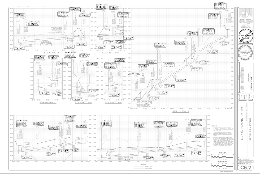
The Lily Gardens apartment project included detailed utility profiles documenting structures, pipe runs, invert elevations, slopes, ground elevations, and constructed conditions.
Project Context
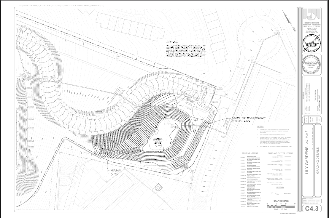
The site plan provides context for the roads, residential buildings, grading, pond, drainage features, and utility systems represented by the as-built profiles.
Reviewing the project at both the overall site level and the detailed profile level helped connect individual measurements to the broader development.
Field Collection
Utility as-builts often needed to be collected while structures and pipe components were still exposed. Once construction advanced, critical locations and elevations could become hidden below pavement, soil, or finished landscaping.
This made timing, communication with construction crews, and careful field notes important parts of the surveying process.
Typical Field Information
Pipe locations
Structure locations
Invert elevations
Top elevations
Utility crossings
Pavement and curb
Building corners
Finished site features
Commercial Site Documentation
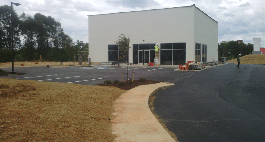
The Verizon store provided a commercial example of the same field-to-office process. Completed pavement, curbing, sidewalks, landscaping, utilities, and building improvements all needed to be represented accurately within the project records.
Seeing the constructed site reinforced how survey drawings support verification, closeout documentation, maintenance, and future modifications.
Engineering Challenges
As-built documentation depended on accurate measurements, proper timing, clear communication, and careful translation of field data into usable final drawings.
01
Many utility components become difficult or impossible to observe after backfilling, making accurate and timely field collection essential.
02
Pipe inverts, structures, and finished site features required dependable elevation information to support usable final records.
03
Installed conditions may differ from the original plans, so drawings must accurately document what was actually constructed.
04
As-built plans and profiles contain dense information that must remain readable for future engineering, maintenance, and construction use.
What I Learned
As-built surveying showed me how important it is to collect accurate information at the correct stage of construction. Measurements taken before utilities are buried or site features are covered may become the permanent record of that work.
The experience strengthened my ability to connect design plans, field conditions, survey observations, and final documentation into one continuous professional workflow.